Monnar
Munnar
Munnar is a town and Hill Station located in the Idukkai Distict of the
southwestern Indian state of Kerala.
Munnar is situated at around 1,600 metres (5,200 ft) above sea level, in the Western Ghats range of mountains.
The name Munnar
is believed to mean three rivers referring to its location at the
confluence of the Mudhirapuzha, Nallathanni and Kundaly rivers. Munnar town is situated on the Kannan
Devan Hills village in Devikulam taluk
and is the largest panchayat in the Idukki district covering an area of nearly
557 square kilometres (215 sq mi) The
nearest major railway stations are at Eranakulam and aluva (approximately 140 kilometres
(87 mi) by road). The Nearest Functioning Railway station is at udumalaipettai according to Google maps The nearest
airport is Cochin International Airport which is 105
kilometres (65 mi) away.
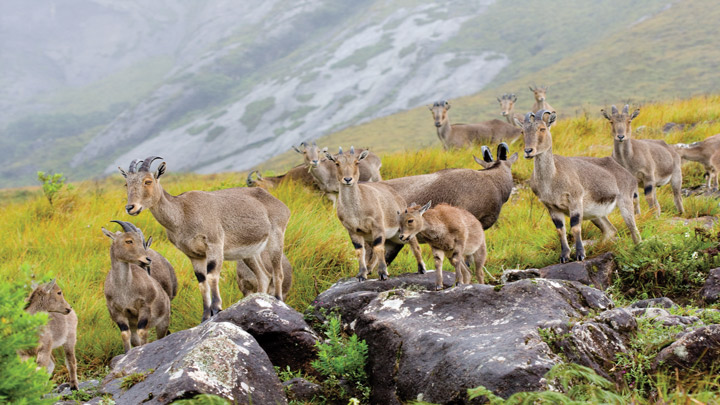
Flora and Fauna:-

Most
of the native flora and fauna of Munnar have disappeared due to severe habitat
fragmentation resultant from the creation of the plantations. However, some
species continue to survive and thrive in several Procted areas near by
 to the east,
the Chinnar Wildlife Sanctuary
to the east,
the Chinnar Wildlife Sanctuary 
manjampatty Velly

and the Amaravati
reserve forest of indra Ghandi Wildlife Sanctuary 
to
the north east, the the Eravikulam national Park
 and Anamudi Shola national Park
to the
north, the Pampadum Shola national park to the
south and the proposed
 Palani Hills national Park to the
east
Palani Hills national Park to the
east


Comments
Post a Comment